
Nibari to Matsusaka: Lots of nice small roads, plus a few Typhoon diversions
After yesterday it was great to have a mostly sunny day on the bike. I normally pick small roads when touring in Japan. But some of today’s roads were really small. And a few of the diversions required a bit of effort to get around, and one road was completely blocked off requiring a total reroute. The ride ended up being 50 miles.
I have three navigation systems running, 1) a Garmin Edge 1030, 2) a Wahoo Element Bolt, and 3) the RWGPS app running on my phone. The Garmin gives me a great map and turn-by-turn directions, the Wahoo gives me instant syncing with my RWGPS website route and custom cues, and the RWGPS app on my phone gives me audio cue prompts. And all three give me vastly different elevation gains for long, hilly rides that have lots of up and downs. Garmin said i climbed 6200’ today. Wahoo said 3950, and RWGPS said 4250.
It felt closer to Garmin, but not 6200’. Maybe 5200, but its hard to tell. Obviously.
 This road was a bit of a mess but was very rideable.
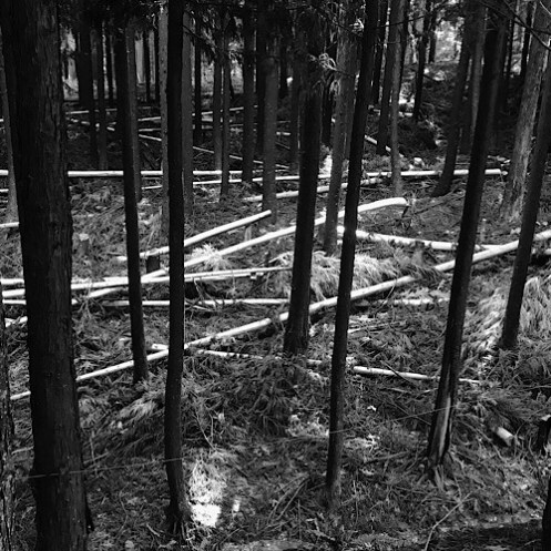

This required the removal of all bags so I could climb over the trees carrying my bike. 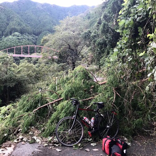
And yet another one to climb over

Then I saw these signs. Yea, “Therapy Road”. It was therapeutic all right.

And more stuffed characters.

All those navigation tools but no chain saw?
LikeLike
Tree climbing adds to the adventure. Love the pics.
LikeLike